
Spatial Data Analysis Report
100 W Ogden Ave, Westmont, IL 60559
1.2 Hours
February 8, 2026
DJI Matrice 350 RTK, Zenmuse P1

31,329 sq ft
46,421 sq ft
15,357 sq ft
21,688 sq ft
15,927 sq ft
24,733 sq ft
4,057 sq ft
4880 sq ft
*Surface area accounts for slope and elevation changes and will be greater than flat (plan) area on uneven terrain.
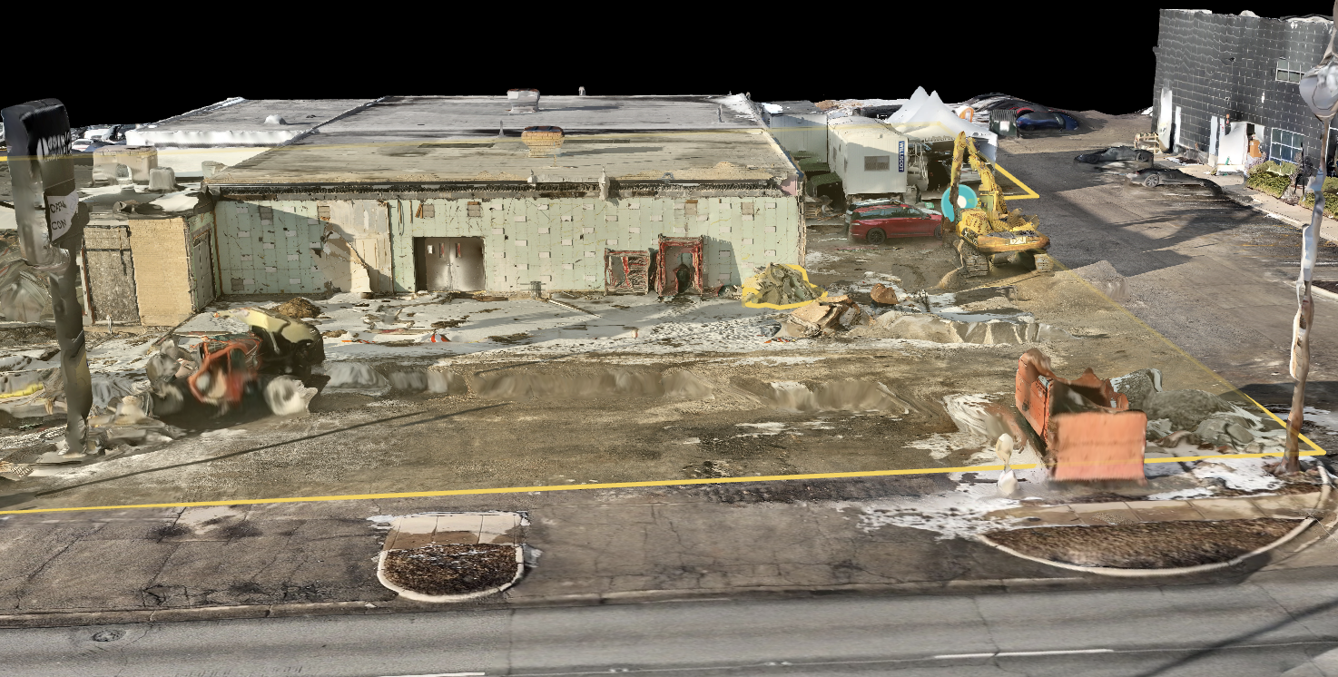
Area values in this section represent measured site extents derived from georeferenced aerial data. Plan areas reflect horizontal footprint, while surface areas account for slope and elevation. These values are commonly used for material estimation, cost calculations, progress tracking, and verification against design plans.


Area Analysis — How to Use This Data
The area values in this report represent measured surface extents calculated from a georeferenced aerial map of the site. All areas reflect current site conditions at the time of capture, not design drawings or estimates.
What This Data Tells You
- How much physical surface exists within a defined boundary
- The true extent of work zones, materials, or site features
- Whether site conditions match plans, permits, or expectations
How This Data Is Commonly Used
Material Planning:
- Use area values to calculate quantities for asphalt, concrete, gravel, soil, roofing, or surface treatments.
Cost Estimating:
- Multiply measured areas by unit costs to produce accurate budget estimates and bids.
Construction Tracking:
- Compare areas between dates to verify completed work or surface expansion.
Land & Site Management:
Confirm parcel extents, staging zones, access paths, or disturbed areas.
Compliance & Documentation:
- Support reporting requirements by providing defensible, timestamped measurements.

Lorem ipsum dolor sit amet, consectetur adipiscing elit, sed do eiusmod tempor incididunt ut labore et dolore magna aliqua.
Lorem ipsum dolor sit amet, consectetur adipiscing elit, sed do eiusmod tempor incididunt ut labore et dolore magna aliqua.


31,329 sq ft
46,421 sq ft
15,357 sq ft
21,688 sq ft
15,927 sq ft
24,733 sq ft
4,057 sq ft
4880 sq ft


10 ft
2 ft
15,357 sq ft
21,688 sq ft
15,927 sq ft
*Surface area accounts for slope and elevation changes and will be greater than flat (plan) area on uneven terrain.
Area values in this section represent measured site extents derived from georeferenced aerial data. Plan areas reflect horizontal footprint, while surface areas account for slope and elevation. These values are commonly used for material estimation, cost calculations, progress tracking, and verification against design plans.
